
June 20, 1995 was a sultry and oppressive day. Temperatures in the 90s down to the water with dew points in the mid 70s drove heat index values above 100º. At the same time an elevated mixed layer (EML) moved overhead creating an exceptionally unstable and volatile air mass.
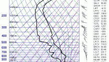
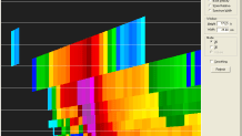
This weather balloon sounding from Albany shows the EML with very steep lapse rates between 650mb and 500mb. This means that the temperature above 10,000 feet was decreasing very rapidly with height (nearly 10ºC/km). With an oppressively hot and humid airmass in place the atmosphere was primed for a big explosion.
That explosion came north of the Massachusetts border when a supercell developed and began moving south.
What was remarkable about this storm was the amount of large hail it dropped during its trek through Connecticut. Baseball-sized hail was reported in 3 towns – Vernon, Manchester, and Deep River.
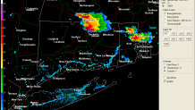
The relatively isolated storm (typical of EML days) continued to move due south and produced a gorgeous looking radar image. The outflow boundary of rain cooled air surged west across Hartford and Waterbury while a backdoor cold front that started near Boston around 10 a.m. finally caught up with the storm at the mouth of the Connecticut River.
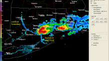
The storm was the most intense over Deep River and Lyme, possibly due to the interaction with the backdoor cold front moving from east to west. Here’s an excerpt from the National Weather Service Storm Data publication.
Local

A cold front moving across the area generated severe thunderstorms which produced large hail and gusty winds. Baseball-size hail lasted for up to 20 minutes in Deep River causing hundreds of thousands of dollars in damage. The hailstones broke hundreds of windows in buildings and automobiles, tore holes in roofs, dented siding and automobiles, and ruined gardens. Some automobiles were totaled. In one historic building, the hail broke 25 windows, including a 100-year curved window. Thirty-two windows were smashed in an elementary school and its roof was damaged. Most of the damage was covered by insurance.
Here’s a 3-D cross section of the Deep River supercell as it crossed the Connecticut River. What is remarkable is how high the hail core of this storm was.
In fact this storm had 70 dbz radar echoes up to 30,000 feet with 60dbz up to 45,000 feet! That’s just wild. Here are some memories from people on my Facebook page.

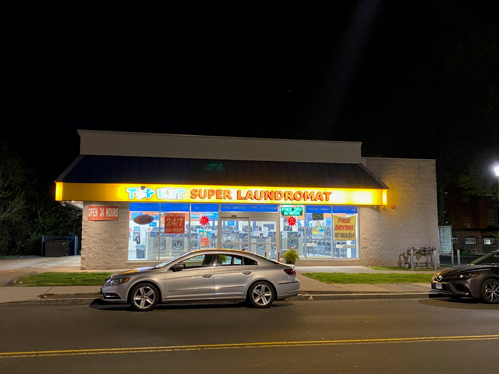
People in Deep River still remember the hail storm vividly. Arlene Macmillan sent me these pictures of the hail (and hail damage) at her house from the 1995 storm. You can see ripped off leaves, broken shutters and windows, along the piles of hail stones. Arlene recalls the largest of the stones being billiard ball size (which is 2.25″ in diameter).


I asked Arlene a few questions about what she remembered from that day: The biggest stones were the size of billiard balls.
I got my car into the garage before the hail started. My husband was around Middletown, driving home, when he saw a black cloud over Deep River. He arrived at home less than 5 minutes after hail stopped, and saw a foot high pile of leaves covering the ground. Nothing happened to his car, not even rain. We rented out another house behind ours. $3,000 in glass damage alone at both. Sorry I don’t have a picture of our house. It was sided with weathered cedar shakes and looked as though the house had been machine gunned.
While the storm had a broad mesocyclone and was rotating during its lifetime it never produced a tornado. The rotation remained broad and aloft and never came to the surface. The closest the storm came to becoming tornadic was south of Deep River in Essex and Old Saybrook when the rotation began to lower following the interaction with the backdoor cold front.
The overall setup was not conducive to tornadoes but certainly was conducive to mega-hail, particularly where the complex interaction between the supercell and a backdoor cold front was taking place over Lyme and Deep River.
