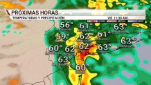
Whether it's just noise at this early juncture or the beginning of a more substantial trend it's hard to say. There's been a notable jump to a warmer solution for the Tuesday and Wednesday storm which would mitigate the ice threat on the front end and allow temperatures to soar into the 50s on Wednesday.

At the onset, it still looks cold enough for some ice on Tuesday. You can see the light to moderate precipitation moving into southern New England with temperatures pretty close to freezing. This would ice some things up for the morning commute.

The biggest reason for the change is a change in the strength and location of a cold high pressure to the north of us. This high appears weaker over Quebec and is also getting dislodged and shunted east quickly. Without a strong high to our north feeding cold and dry air into New England we're not going to avoid a surge of very warm air coming in.
At this point I'd still be on the lookout for wintry weather on Tuesday as this could easily change back to something a bit colder and more interesting. We'll see if the trend continues.

