
What to Know
- The National Weather Service has confirmed a tornado touchdown in South Yarmouth on Tuesday
- Tuesday's tornado warning came about 12 hours after a previous tornado warning on Cape Cod on Monday night
- Damage reports are already starting to pour in, including roofs being torn off homes in some areas of the Cape
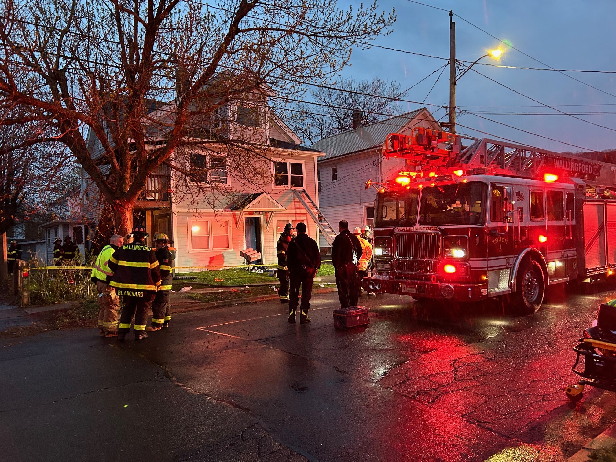
An EF-1 tornado touched down on Cape Cod Tuesday, with three towns hit, according to preliminary information from the National Weather Service.
The tornado caused damage to buildings and trees and left some areas too treacherous for people to go, even while the region was packed with tourists. But there were no immediate reports of injuries or deaths, just power outages.
The tornado reached wind speeds of 110 mph, a strong EF-1 on the Enhanced Fujita Scale, the NWS said Tuesday night.
West Yarmouth, South Yarmouth and Harwich, Massachusetts, were struck, according to the preliminary NWS report, based on on-the-ground surveys. The agency had earlier confirmed the tornado through radar.
The tornado is believed to have touched down in Yarmouth and again in Harwich, where the most extensive damage occurred.
The storm system also produced a waterspout southwest of Falmouth and Martha's Vineyard Tuesday morning and a 90 mph gust of wind in Hyannis around 12:15 p.m. About 30 minutes later, the storm and danger from tornadoes has moved offshore.
Local
Amid widespread reports of damage, Harwich declared a local emergency and requested that Eversource cut off power to the community, MEMA said.
The Yarmouth police chief expects Gov. Charlie Baker to declare a state of emergency as well.
The NWS said it would issue a final statement on the tornado Wednesday.
Nearly 42,000 people remained without power around 10:15 p.m. Tuesday. The lights were out in more than 90 percent of Harwich.
Reports of Damage
Roofs were torn off buildings in some areas of the Cape. Video from the Cape Sands Inn in West Yarmouth showed the roof of the motel had been almost completely ripped off the building.
"It sounded almost like a locomotive, just for like a few seconds," said Megan McGuire, who shared video of damage at the hotel, where she's staying with her mother. "As soon as it was over we looked outside and the building at the far end, the roof was just ripped off. The building is still standing but the roof is in the backyard now."
Streets were also closed and trees were downed.
Cristina Mashoke and her family took shelter in their basement moments before the tornado hit Harwich. After it passed, she found trees and power lines down all over the place.
"It was like a whiteout," Mashoke said.
"It's treacherous out there," said Yarmouth Police Chief Frank Frederickson, who asked the public not to travel through severely affected areas.
The last confirmed tornado on Cape Cod was on Oct. 29, 2018, in Woods Hole. Before that, tornadoes were confirmed on Aug. 22, 1977, in West Yarmouth and Aug. 9, 1968, in Marstons Mills.
Emergency Response
The National Weather Service is deploying a team to Yarmouth and South Harwich to survey the damage. A state building inspector is also being deployed to the area.
Massachusetts State Police said they are also sending 15 additional patrols to assist regular patrols in the Yarmouth area.
MEMA is working with local officials on the Cape to get a sense of the damage, spokesman Christopher Besse said. As of 2 p.m., about 40,000 customers were without electricity in the Harwich, Chatham and Dennis areas, he said.
"Please stay home!" Harwich police said on Twitter. "We have extensive damage from downed trees and wires. It is not safe to be out driving or walking around."
The town said "most major roads" in Harwich are closed.
The Barnstable County Fairgrounds were damaged from water and wind, prompting the county fair to close Tuesday night, though it's still set to be open Wednesday.
"We are making this decision in the interest of public safety as significant portions of the midway, access roads and parking lots are flooded and likely will not drain enough for us to open safely. The Team Demolition Derby and all grounds acts are also cancelled for tonight," the fair said on Facebook.
People on Cape Cod React
Many people took to Twitter to say they were sheltering in place at work during the tornado warning.
"So there's a tornado warning [right now] at work and I'm sitting here in a shelter in place listening to Radio Ga Ga by Queen drinking a cold Coke. How's everyone else's day?" Nick Karas said.
"there's ANOTHER tornado warning on Cape and my boss goes 'okay guys there's a tornado warning, stay away from the windows, i'm going outside to watch it," @kaaatiejane_ said.
"Tornado warning--Super windy and dark here on Cape Cod. Hanging out in an interior hallway with coworkers," Mary E. Cronin said.
"We're prepared to squash in the bathroom again but sitting in the living room keeping an eye out. Wearing my bike helmet to make nieces laugh. #auntantics," @maalivahti said.
One man on vacation in Falmouth posted a picture on Instagram showing a group of less-than-thrilled children hunkered down in their basement.
"Tornado warning on vacation down in Falmouth," Jason Brown said. "Great times. #wizardofOZ #tornado."
Forecast
Tuesday's tornado came after a tornado warning was issued for parts of Cape Cod on Monday night. That storm knocked down trees and caused damage centering on the Harwich area.
After the storms, drier weather moves in from northwest to southeast Tuesday. It will turn into a nice afternoon west of the Connecticut River in Massachusetts, Vermont and northern New Hampshire.
From Boston to Cape Cod, the rain may not end until later in the day, but there’s a pretty good chance of the sun peaking through before it goes down. High temperatures will only be in the 60s and 70s. Wind is from the east and northeast and may gust past 25 mph near the coast.
The exception is Nantucket, where the wind could get gusty from the south as a low-pressure system goes right over the island in the evening.
One more wave of low pressure will clip Cape Cod in the islands Tuesday night, with a period of rain that will last through about sunrise Wednesday.
Otherwise, most of us are mostly clear and cooler Tuesday night, with a low temperature in the 50s to low 60s.
The less humid air and sunshine will spread across all of the region Wednesday with a really nice day. High temperatures will be in the 70s to low 80s with low humidity.
We’ll have almost chilly weather for Wednesday night with a low temperature in the 40s and 50s, setting up a beautiful Thursday with sunshine and a high near 80 degrees. It starts warming up on Friday but should stay dry, humidity will build a bit with a high in the 80s.
