
Making what’s beyond our control, somehow controllable. That’s the near impossible task coastal Connecticut towns and cities face when it comes to sea level rise.
We’ve been experiencing the impact of sea level rise for years, in the form of flooding, more frequent storms, and rising tides. Scientists say it will likely accelerate.
Communities are planning for this, but even with preparation, the situation could become serious.
For instance, data compiled by NBC Connecticut Investigates using U.S. Census and NOAA (National Oceanic and Atmospheric Administration) research indicates in New London County, up to 10% of the population could be impacted in some way by a potential sea level rise of two feet over the next 30 years.
Syma Ebbin lives in New London County, in the City of Groton’s Jupiter Point neighborhood…an area she has been connected to for decades.
“(I) have spent all my summers here since I was a kid,” Ebbin said.
Ebbin has lived in Groton full time since 1999, and she has witnessed the steady creep of water into her neighborhood over the years.
She has taken lots of photos. That includes flooding in Jupiter Point during and after Super Storm Sandy in 2012.
Ebbin also told us about a recent weather event, “I'm 14 feet above sea level at my house at the top of the road and we had the water, the storm surge came within you know 10 feet of my house.”
“It used to be a hurricane you would obviously get flooding now you get flooding you know 10, 20 times a year just regular King tides they call them or general nor'easter we get a lot of flooding,” Ebbin explained.
Scientists including Professor Jim O’Donnell at the UConn Avery Point campus in Groton have said sea level rise has been accelerating at a rate, where within 30 years, it could be nearly 20 inches higher right off the Connecticut coast. As an example, O’Donnell said that flooding events that occur once every 10 years at Avery Point could occur as often as every two years by 2050.

“Smaller storms will cause more flooding, right, because the mean sea level is higher and it’s that in which I think people are recognizing,” O’Donnell explained.
O’Donnell added that the frequency of flooding will damage homes and make them irreparable long before they are permanently underwater. “Consequently, if your insurance rates or your repair costs are driven by flooding then you should expect a 5-10 times increase in the cost of those insurance or repairs.”
O’Donnell suggests that homeowners in the FEMA 100 year flood zone are most at risk.
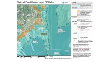
You can enter your address and see if you live in the 100 year flood zone here.
“I don’t think there’s much any individual can do by themselves, except in some areas where they can raise their home. And that’s probably a smart thing to do if you’re in the flood zone,” says O’Donnell, stressing that communities need to work together.
There are multiple strategies for communities dealing with sea-level rise…tools in the toolbox to make them more “resilient.” Some include:
- Protection-installing seawalls, fortifying sea dunes, expanding marshland
- Accommodation-which includes raising buildings above ground
- Advance-actually extending land outward
- Retreat-moving exposed people and property out of the coastal hazard zone
Even if sea level rise isn’t as severe as the direst predictions, and many of these resiliency moves may not be needed, the City of Groton has not been taking any chances. It has received high marks from regional leaders, applauding how it has taken the difficult first steps in combating sea level rise.
Economic development specialist Cierra Patrick explained after a first round of outreach a few years ago, the city is once again inviting the public to weigh in on the best measures to combat sea level rise.
“We did a first round of community engagement to get a general idea of what vulnerabilities we have.”
The second round will be on June 8 and 9.
“We're bringing everyone to the table businesses, property owners, homeowners, general residents," Patrick said. "We're trying to be proactive to address what are our needs now and what are our needs in the future.”
City Planner Leslie Creane said in this second round of outreach, the city will get more into the details with home and business owners about what could be in their future, in terms of making the city more resilient to sea level rise.
“We're doing this at a time before it's a crisis,” Creane said.
Flooding in Groton After Superstorm Sandy
Creane and Patrick said they know going in, probably not everyone will be happy with the plans that eventually emerge.
On the one hand, it could mean better maintenance of drainage systems, more wetland and dune preservation, even building bridges to keep certain neighborhoods from getting cut off during coastal storm and rain events.
On the flip side it could also mean some property owners may not be allowed to rebuild in certain areas if sea level rise has their homes or businesses in near-constant jeopardy, and there may not be a bridge built to keep them from getting cut off.
“How do we look at the areas that either could be flooded out or isolated by flooding? And look to protect them? Or make the decision that maybe they don't get protected…Those are going to be some very hard conversations to have with the public and with the people who bring us the science of it. Better to have those conversations now and have a serious understanding of what it would take, and then make some community generated and database decisions on what the best way to handle it is,” Creane said.
Creane emphasized these “…are very tough calls and they haven't been made.” She added these decisions will be determined by the whole community, not a small set of city leaders.
Ebbin said the City of Groton has taken the right first steps and must keep up the momentum. “It is incremental. I think the key thing is to get it in the planning…I think people do kinda know what's coming next.”
This has not all been about just the City of Groton. Connecticut has a total of 24 shoreline communities contending with the same issues.
“There's only so much you can do to hold back the force of water, one of the strongest forces on earth” Creane said.
Sea Level Rise Mitigation Efforts
Shoreline towns are looking at ways to combat or adapt to the threat of sea level rise in their communities. NBC Connecticut Investigates is reaching out to the state's 24 shoreline towns to find out what their most urgent concerns are and what they're doing to address the situation. The section below will be updated as we hear back.

Clinton
Zoning and Wetlands Enforcement Officer Kathy King provided the following information:
Through our Zoning Regulations, we are making some changes to try to prepare for sea level rise and protect shoreline properties in order to mitigate property damage. We’ve eliminated the minimum square footage requirement for the ground floor of a structure which allows houses to elevate their major living spaces above the first level.
The Town amended our Zoning Regulations under the Section for Coastal Management Area (CAM) to no longer specify that a structure be exempted from Coastal Site Plan review if it is below 500 s.f. in size. The proximity to the coastal resource is more important than the size of the structure.
We also in the process of amending our non-conforming structure regulations to allow people to elevate their houses for flood purposes without requiring that they obtain a variance from the Zoning Board of Appeals.
The RiverCOG (Council of Governments) is in the process of adopting its updated Natural Hazards Mitigation Plan which has more information about planning and preparing for sea level rise. More information is available here.
Groton
Groton officials spoke with NBC CT Investigates for this story. They conducted outreach with the community two years ago where they were trying to educate people about steps that the city was going to start taking. They’re doing more outreach June 8 and 9 where they’re going to get into more details about the decisions the community will need to make to come back to sea level rise More information on their mitigation plans is available in their hazard mitigation plan here.
Guilford
The town updated its Floodplain Management Ordinance in early 2019 to require structures to meet more stringent regulations to promote resilience.
It continues to plan for coastal resilience of its infrastructure and has begun funding mitigation projects which are currently under design. An engineering study and an alternatives analyst were undertaken to implement coastal resilience improvements to Chimney Corner Circle and Falcon Road in the Sachems Head area of Guilford. The Community Coastal Resilience Plan (CCRP) in 2014 identified Chimney Corner Circle as vulnerable to frequent flooding under current and future sea level rise scenarios.
With a roadway low point of elevation 4’ the roadway is often flooded under high tide events, as much as 44 times a year. Most of the adjacent older homes have not been elevated, but to provide some improvements to access to the area, we plan to elevate the road 2’ to minimize impacts to adjacent properties yet reduce the frequency of the road flooding. Future improvements to the road will be necessary as adjacent homes elevate and become more resilient as well. Falcon Road has a 350’ section supported by a stone sea wall which has suffered damage from storm events requiring partial road closures and wall and roadway repairs. If not damaged by a storm event, the road is often covered in sand from the adjacent beach. This section of road is a vital connection in the area and has a collector road functional classification. Plans are to fortify the seawall with concrete and build a proper foundation and parapet with the roadway gaining almost 2’ in elevation. As we are currently in preliminary design phase and require coastal permits for both projects, we anticipate construction will occur in 2022 or 2023.
The town is also working with Save the Sound and their efforts to advance a project to protect against coastal erosion and provide resilience for a sandy beach and large tidal wetland area at the mouth of the West River at Chittenden Park. This location is also the most southern end of the New England Trail. The project was developed conceptually as part of the Regional Framework for Coastal Resilience in 2017. This project is currently under consideration for grant funding the engineering phase through the LISS Enhancement Grant program.
Ledyard
Mayor Fred Allyn provided the following:
Ledyard’s area of concern is limited to the Thames River portions of the Gales Ferry portion of Ledyard. Topographically speaking, the developed areas along the Thames River and associated basins are well-elevated, which mitigates most areas of concern. Predicted sea level rise for 2050 still does not impact residential structures located along the Thames River. Using the ESRI mapping from Coastalresilience.org for CT and projecting 2080 modeling still does not provide structural impact to these portions of Town.
The area of SE CT of greatest concern appears to be the Groton Airport area and portions of Stonington.
Madison
In 2019 Madison established a Coastal Resiliency Commission, which was tasked with creating a plan. Town Planner David Anderson says the commission has proposed changes to the flood plain ordinance which have received pushback from some residents. The commission's response and amended changes are available here (scroll to pages 9 & 10).
New London
New London does not have a specific plan to mitigate sea level rise. The City has partnered with CIRCA and the Nature Conservancy to look at the City’s drainage issues.
Over the years, there has been some stormwater improvement by the New London Stormwater Authority, according to City Planner Sybil Tetteh.
New London also belongs to the Southeastern Connecticut Council on Governments which has studied the problem on a regional level.
Old Saybrook
Old Saybrook officials confirmed they are still working on plans in response to the final report from the Coastal Resilience and Adaptation Study, which was received in late 2018. Information on the project is available here.
