
We got lucky late Tuesday night. Kaitlyn and Josh were holding down the fort in the weather office until well after midnight with a very concerning weather setup. A bit of instability and a whole lot of wind shear left the atmosphere primed for an isolated tornado.
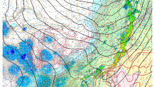
Looking back at the radar data it appears we really had some luck on our side. The setup was fairly common. A cold front sweeping in from the west, a surge of extremely humid/moist air coming in off the warm ocean waters, and a bit of instability during the overnight. What was a bit unusual was the amount of low level wind shear that was present.
This environment reminded me a bit of the August 22 overnight tornado in Concord, MA that was exceptionally well warned by Hayden Frank at the National Weather Service in Taunton, MA.
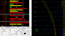
This sounding off the RAP models shows very modest instability but very powerful winds just off the surface. It wouldn't have taken much for some 60 mph winds to reach the surface.
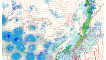
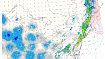
There were two radar signatures that were quite concerning. Given the low CAPE/high shear environment I wasn't surprised to see two rotating storms develop. One was in Goshen/Torrington shortly after 11 p.m. and another in Wolcott after midnight. Thankfully, no tornado touched down.
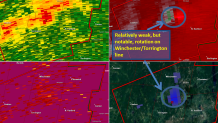
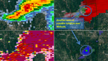
Both the Torrington and Wolcott storms had just shy of 50 knots of what we call delta-V. Basically the strongest outbound and strongest inbound velocity are added together to characterize the strength of a storm's rotation. The median value for northeastern U.S. tornadoes in a delta-V of 60 knots - with a delta-V of 50 knots immediately prior to touchdown.
Local


In an environment like we had Tuesday night we got lucky. One or both of those storms were candidates for brief and weak overnight tornadoes. A small increase in strength in either storm likely would have been enough to drop a tornado.
