

NBC Connecticut First Alert meteorologists are keeping an eye on what could be a significant storm at the end of the week.
After a milder day Tuesday, the temperature will fall overnight and into Wednesday.
Temperatures Wednesday will be in the 20s with "feels like" temperatures in the single digits due to wind chill.
Get Connecticut local news, weather forecasts and entertainment stories to your inbox. Sign up for NBC Connecticut newsletters.
Thursday will be mostly sunny but chilly again with highs in the upper 20s.
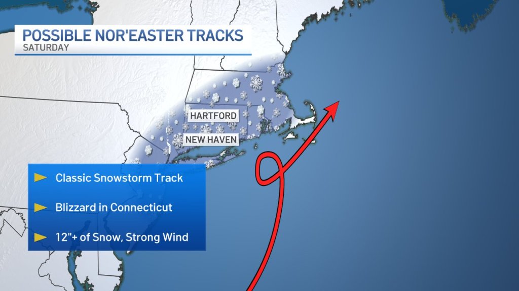
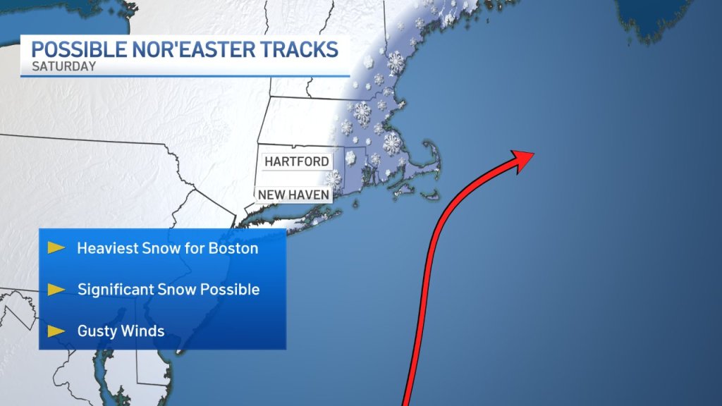
By Friday, our First Alert meteorologists are watching the potential for a potent storm. The threats could be heavy snow, wind and flooding.
Right now, it appears the impacted timeframe will be Friday night into Saturday. While it's too early to talk about specific amounts we can say that significant accumulations are possible. The track of the storm is so important in these cases. A shift east or west would mean different implications for us here in Connecticut.

If you have plans this weekend, you'll want to continue checking in with our meteorologists on air, on our website and on social media.