
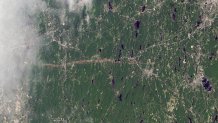
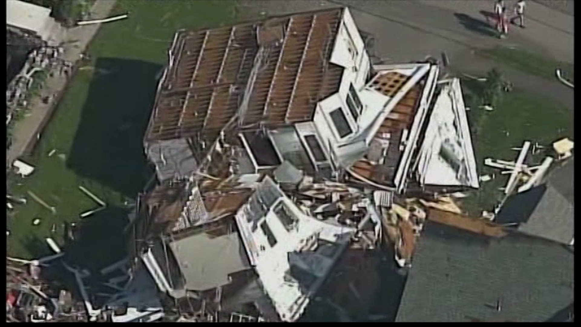
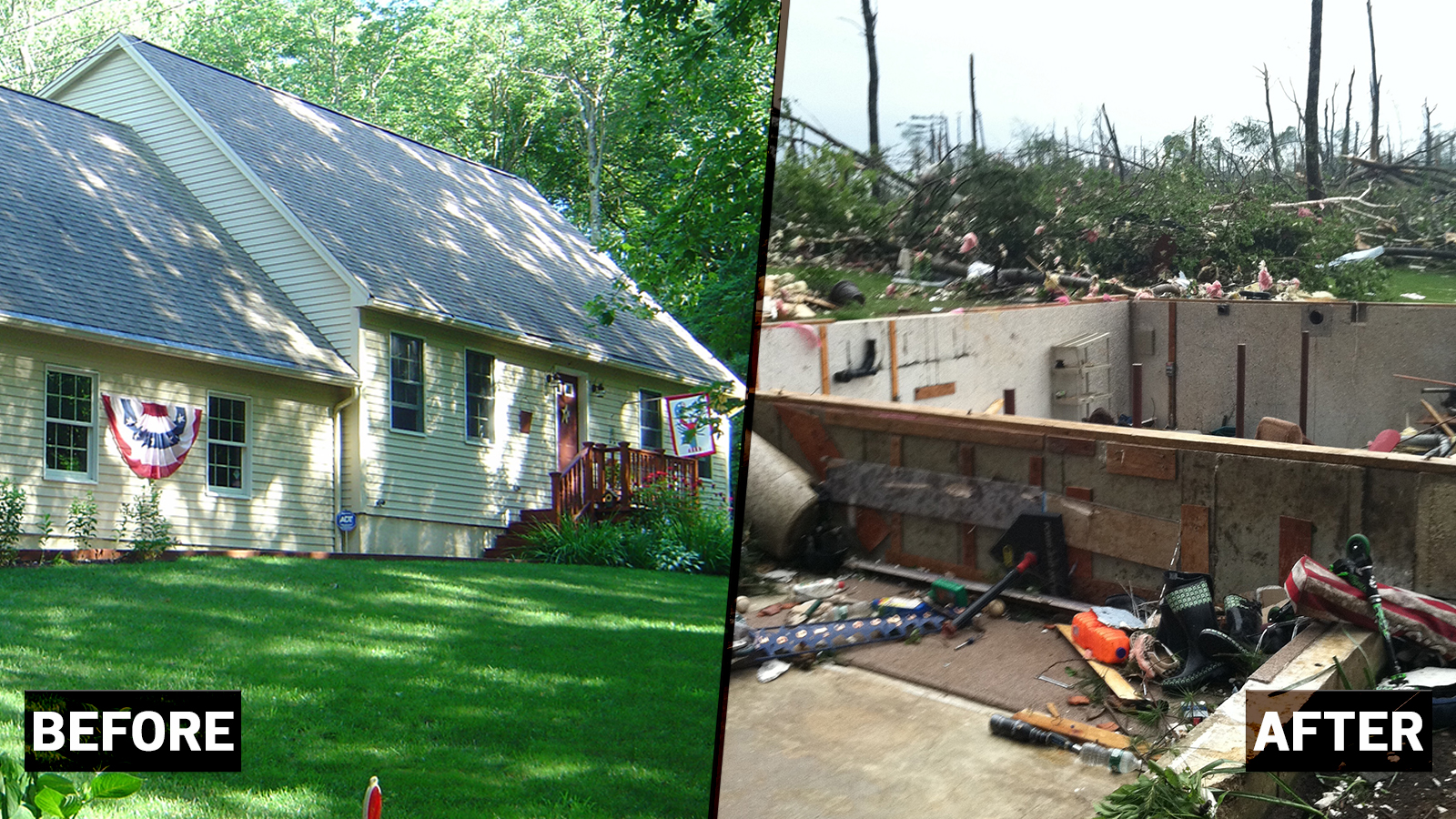
On June 1, 2011, a powerful tornado carved a path of destruction through western Massachusetts. Winds of up to 165 mph destroyed hundreds of homes, injured 200 people, and left three people dead. In wooded areas there was widespread deforestation that left marks for years.
The EF3 tornado had a 38-mile long track from Westfield to Charlton. It hit highly populated areas, including the city of Springfield.
DAMAGE BY THE NUMBERS
According to the National Weather Service, an estimated 1,400 houses and 78 businesses were damaged or destroyed. Two hundred residential buildings were condemned. Nearly 10,000 acres of woodlands were destroyed.
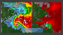
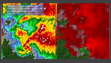
A MINUTE BY MINUTE RADAR BREAKDOWN
Below are images of the tornado as seen by Doppler Radar. The left side of image shows reflectivity or where the radar is detecting rain, hail, or even pieces of tornado debris. The right side of each image shows velocity or the speed and direction the targets are moving. Where bright reds/pinks meet bright greens/blues there is strong rotation in the cloud.
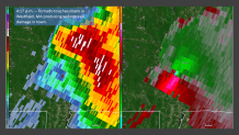
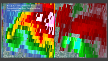
Meteorologists consider this storm the most impressive supercell observed by doppler radar in New England since the National Weather Service radar network was established in the early 1990s.
Photos: Remembering the 2011 Massachusetts Tornado
As I looked up and saw the tornado we thought we were going to die. I thought I’d be hit by something or paralyzed or injured and I didn’t want that. I closed my eyes and said dear God make it fast.
Sue Rabbitt, Brimfield
TORNADO VICTIM REMEMBERS
Sue Rabbitt was in the basement of her Brimfield home when the tornado moved through. She thought she was going to die that day – and she still thinks about the tornado often. But 10 years later her family has rebuilt their lives and has moved on from that terrifying afternoon. She sat down with Chief Meteorologist Ryan Hanrahan to tell her story.
CHANGING TECHNOLOGY
This was a jaw-dropping storm, even for those most familiar with New England’s wild weather.
“We had never seen, you know, obviously a tornado of this magnitude, most of ours have been on the weaker side," said Joseph Dellicarpini, the Science and Operations officer at the National Weather Service in Boston.
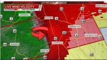
Technology has come a long way in the past decade, and we can now better predict and track tornados.
“We were pretty much in the dark,” recalled NBC Connecticut Meteorologist Bob Maxon “Twelve hours, 18 hours before a storm development we knew there would be thunderstorms, but now we can really pick those days where storms have a chance of being severe or rotating or becoming tornadic.”
Dual Polarization Radar is one of the most significant advancements we’ve seen in the past decade. This technology gives meteorologists more accuracy and radar data than we’ve ever had before. It has also helped the National Weather Service when it comes to issuing severe thunderstorm and tornado warnings.
“With dual-pol we look for what’s called a tornado debris signature,” explained Dellicarpini. “And that’s looking at the rotational couplet so we know where that rotation is occurring and something called correlation coefficient which is sort of the uniformity of the drops.”
This helps determine the type of precipitation a storm is producing and if it’s picking up debris like trees, branches, roofing material. Storm scale modeling has also improved.
“With the technology advancing so quickly now we’re out ahead of it and we can intercept like they do in the Midwest," Maxon said
And technology just keeps improving. GOES-16 satellite imagery is also changing the game, giving updates every minute over a small area.
“Computers will help us be selective and actually help us anticipate what’s going to happen in the next 30 minutes or even 1 hour for warnings," Dellicarpini said.
This is critical information when it comes to life-threating storms.
“The messaging, that the possibility is there, one or even two days in advance. We never had that back then,” Maxon said.
