


A line of strong storms has been moving through the state Thursday afternoon and the NBC Connecticut meteorologists have issued a First Alert.
Severe thunderstorm warnings were issued for Litchfield, Hartford and Fairfield counties but have since expired. The thunderstorm threat will continue until around 8 p.m.
The strong to severe storms will contain strong damaging winds, hail, frequent lightning, and very heavy rain.
The storms took down trees and wires across Connecticut Thursday afternoon. As of 5:45 p.m., there were 11,318 Eversource customers without power and 4,821 United Illuminating customers out.
The public information officer for Norfolk Tweeted that Route 182 is closed at the Norfolk, Colebrook line because trees and wires are down.
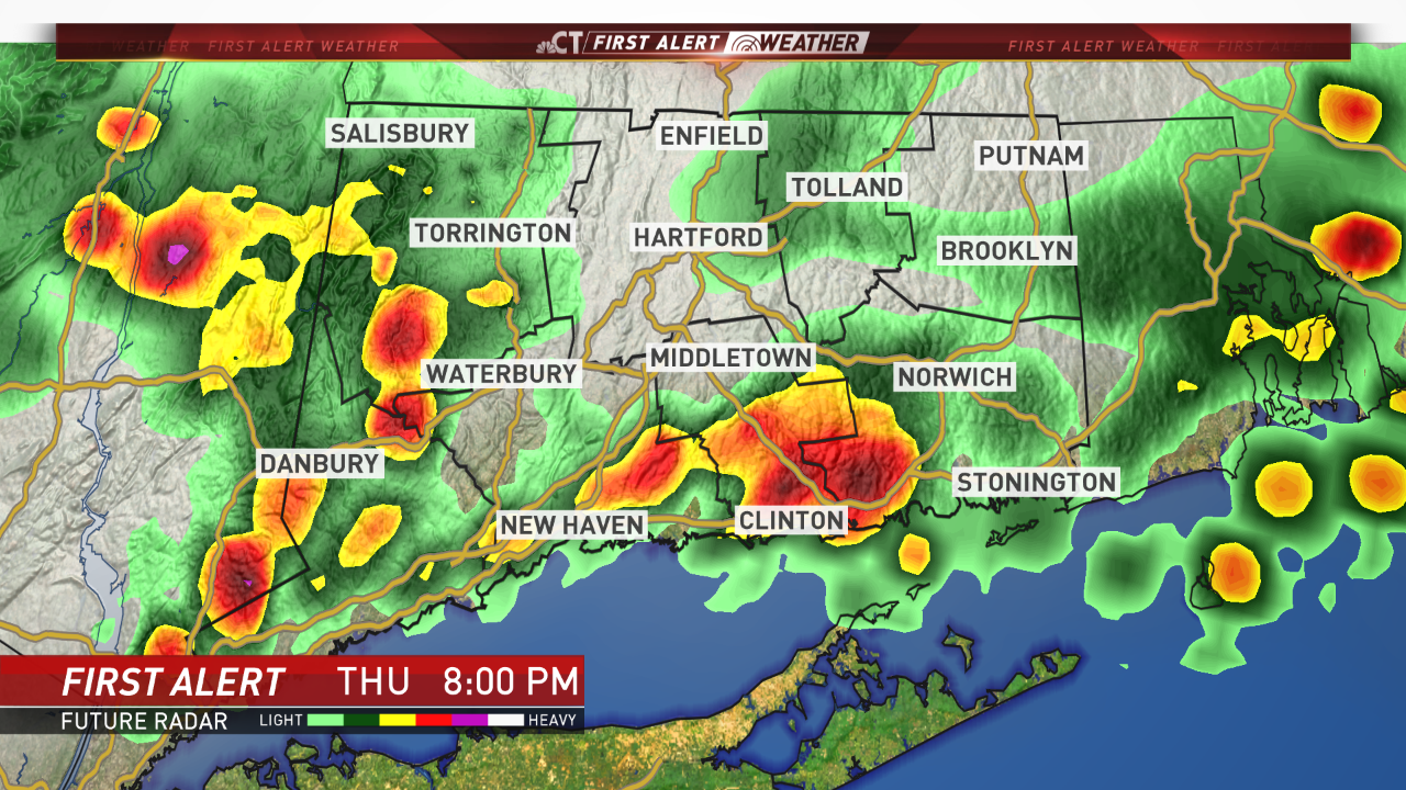
Take a look at First Alert Future Radar and you can see thunderstorms moving across the state.

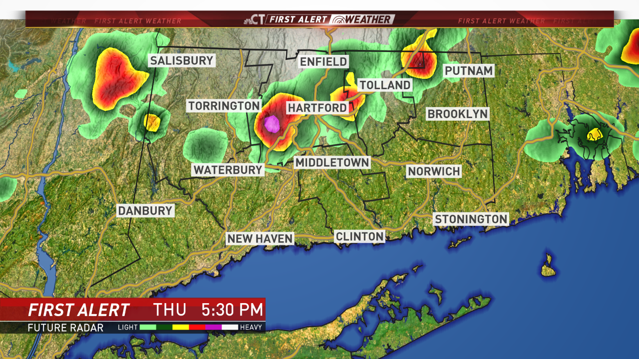
The bulk of the thunderstorm activity will have either exited the state or moved into eastern CT by 8 p.m.
Heat advisories have been posted for all of Connecticut with the exception of southern New London County. Because of the heat, dozens of school districts dismissed early. See the full list here.
Local


A cold front will break the heat Thursday, producing scattered storms that could be strong to severe.
We continue to track this threat. Stay with NBC Connecticut and get the latest forecast anytime by clicking here.

