


After an amazing week vacationing in Ireland where it was between 50 and 60 dregees I sort of chuckled when the pilot informed the cabin it was 81F at JFK on Sunday. Bradley Airport managed a wild 88 degree temperature on Easter Sunday! But for those who like the warmth we've got a change on the way for the next week or so.

The weather pattern has changed. A big ridge of high pressure that pumped warmth up from the south and kept a westerly wind in New England is being replaced by a somewhat persistent trough and periods of onshore wind. This time of year wind direction is critical for our temperatures with exceptionally cold water in the Atlantic Ocean.

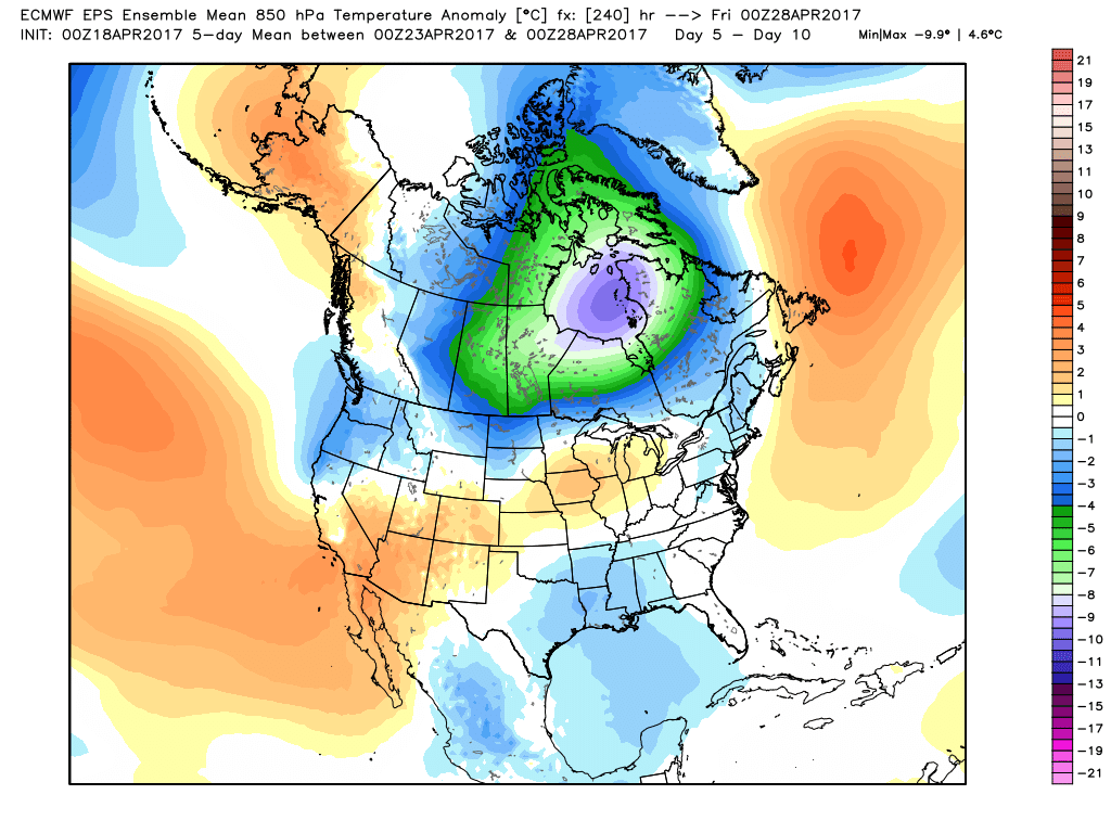
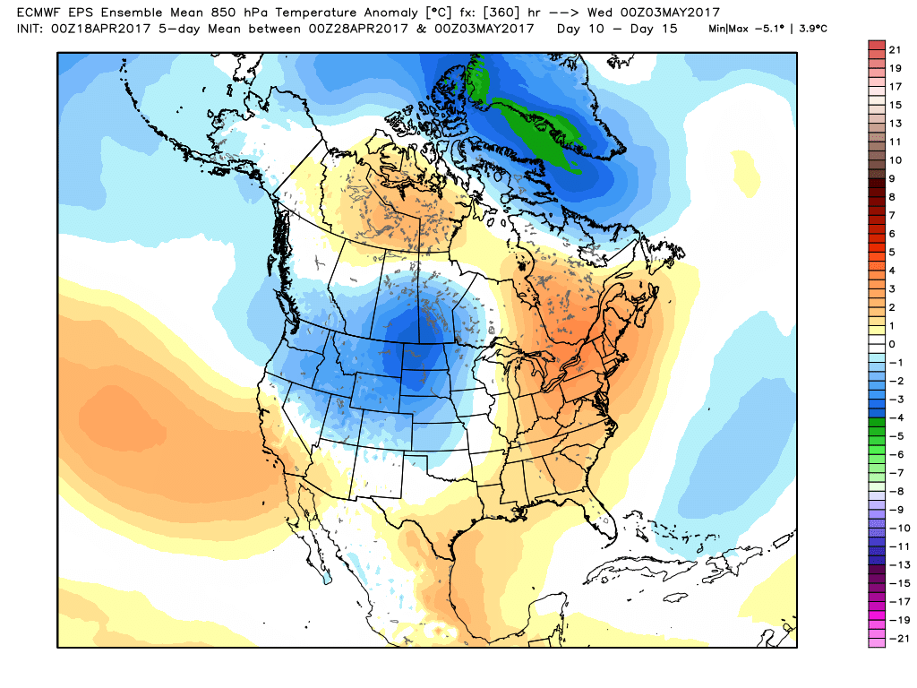
There are signs, however, that by the end of April a return to unseasonable warmth may occur. For example, both the Euro and GFS models rebuild a southeast ridge of high pressure and move a milder airmass in here in the Day 11-Day 15 time frame.
While we'll have to deal with a few cloudy, showery, and cool periods over the next week or so if you like warmth there are some positive signs ahead.

