


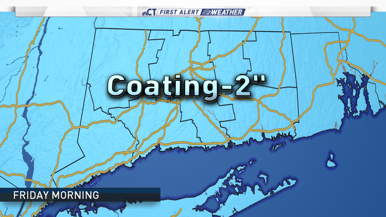
Snow led to some school delays on Friday morning.
Some snow is falling this morning and there are some school delays and some slick roads are reported.
We're also tracking a second much bigger storm will arrive Saturday night and continue into Sunday.
STORM 1 - FRIDAY MORNING
There are school delays in Hamden and Stamford because of some snow. Most of what is falingl is snow, but some light mixing will likely occur along the shoreline.

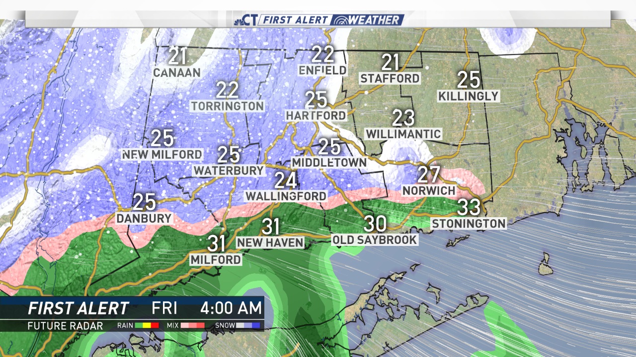
There is not a lot of snow, but as we have experienced in the past, it's not about the amount of snow it's all about the timing during the morning commute, which could cause some issues on the roads.
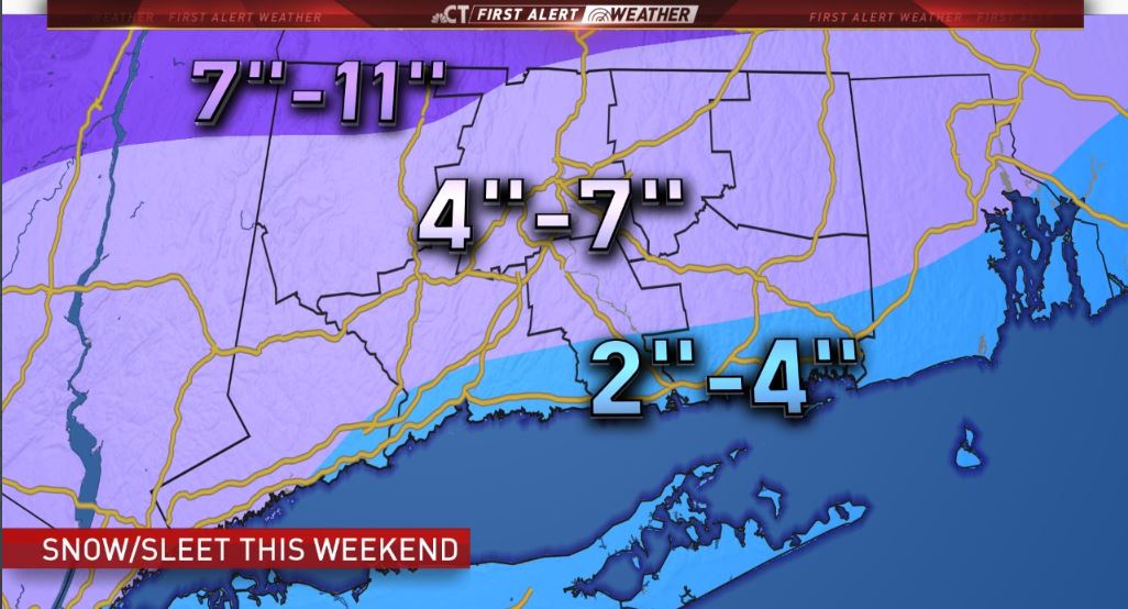
STORM 2 - SATURDAY NIGHT & SUNDAY
The second storm will be more powerful and could result in major impacts here in Connecticut.

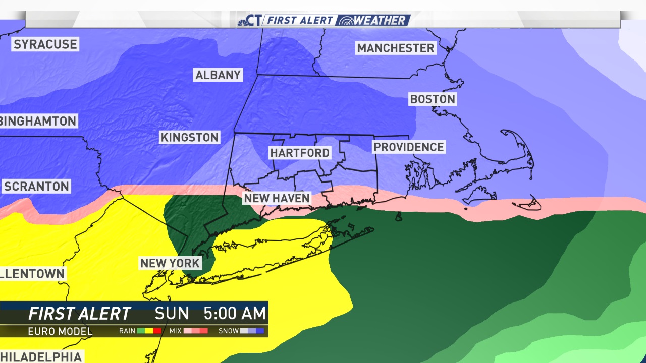
The latest model guidance indicates that snow will develop statewide on Saturday night with a transition to a wintry mix during the overnight hours and eventually over to plain rain for most of the state.
There is some indication that the majority of the storm will stay wintry for the northern third of Connecticut with a freezing rain accreting on tree limbs and power lines.
Amtrak has already announced service changes ahead of the storm.
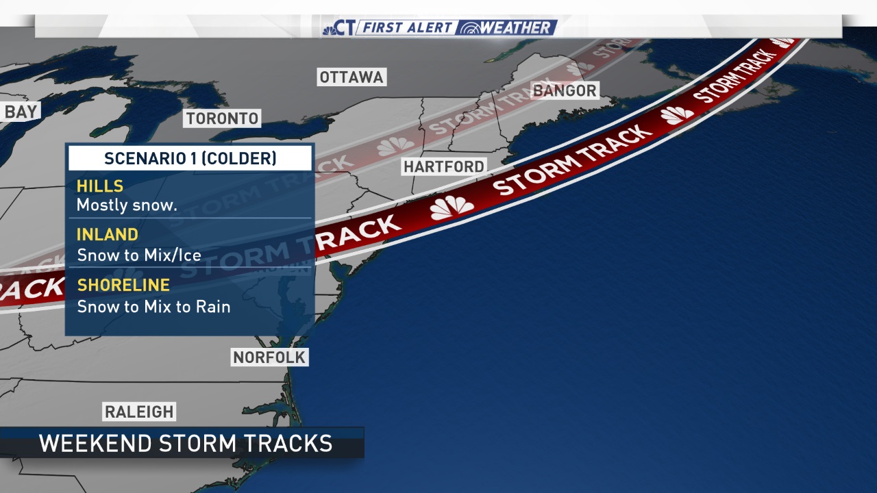
Let's talk about the two scenarios that are possible.
Scenario 1
This storm track would be the coldest scenario with the center of lower pressure tracking along the Connecticut shoreline. This would result in mostly snow for the hills town, snow to and ice in for interior Connecticut, and snow to mix to plain rain along the shoreline. Right now it appears this scenario is less likely.
Scenario 2
If the center of a low-pressure system tracks to the northwest of Connecticut it would result in a mostly ice/rain scenario (a warmer solution). This track would result in snow to a wintry mix to plain rain in the hills with snow quickly transitioning to plain rain along the shoreline.
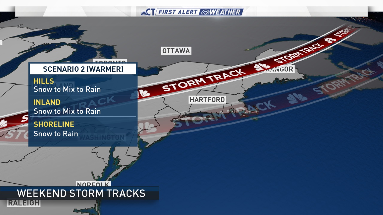
Right now it appears we could be dealing with measurable snow for interior CT and especially the northwest hills with icing occurring even down to the shoreline.
Local


One thing we are certain of is a cold blast of air will arrive right after the precipitation ends Sunday night and some very cold temperatures are expected Monday morning. This will cause a flash freeze and any untreated surfaces will become very icy and we expect slick travel Monday morning with temperatures of 0 to 10 degrees.

