


A strong storm system is moving through the state, which will have multiple impacts overnight and into the morning hours.
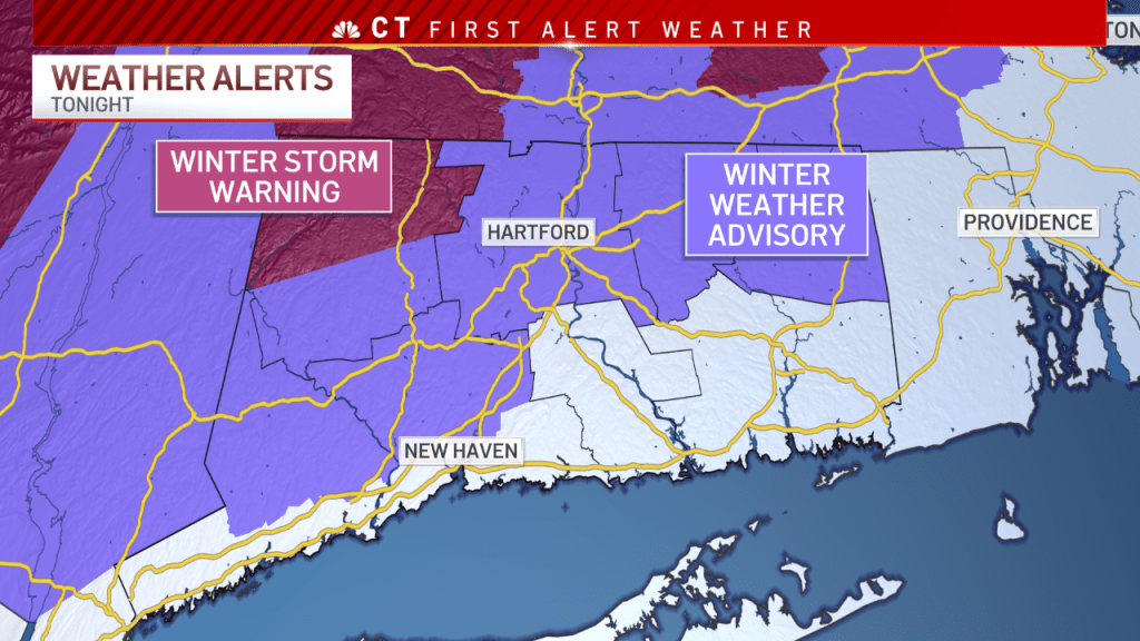
A Winter Weather Advisory is in effect for the four northern Connecticut counties, as well as northern Fairfield and New Haven counties. One exception is northern Litchfield county where a Winter Storm Warning is in effect as up to 6 inches (maybe a little more closer to the Massachusetts state line) of snow could fall.
Get Connecticut local news, weather forecasts and entertainment stories to your inbox. Sign up for NBC Connecticut newsletters.

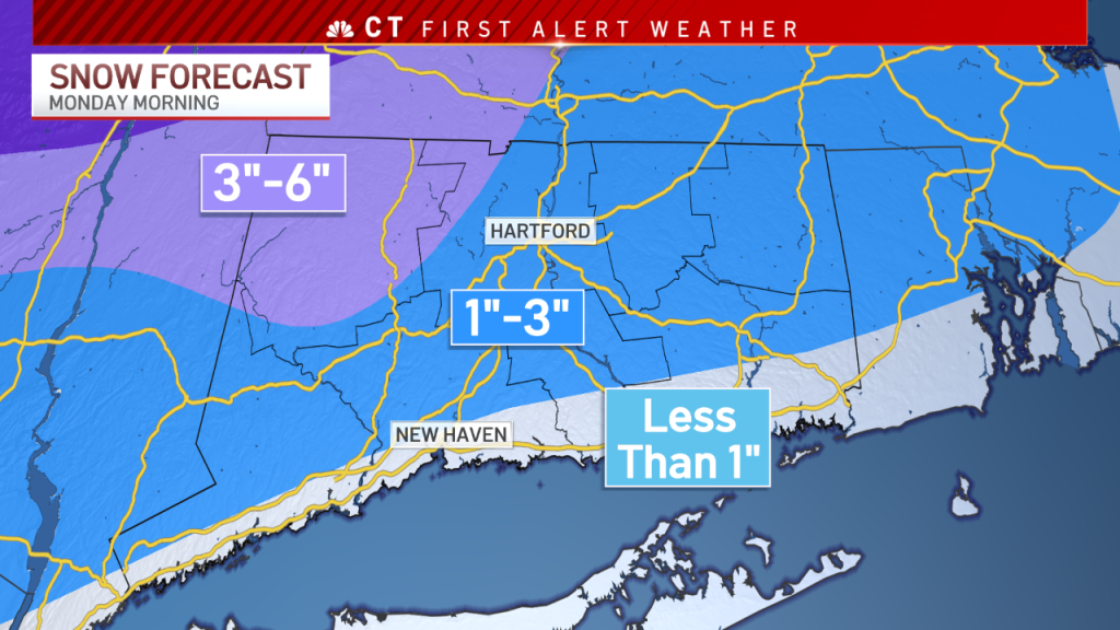
Take a look at snowfall accumulations statewide. The most snow will fall in northwest CT while little, if any, snowfall is expected along the Interstate 95 corridor as precipitation will likely start as rain there.
Snow overspread the state, with a quick transition to rain for much of southern CT.
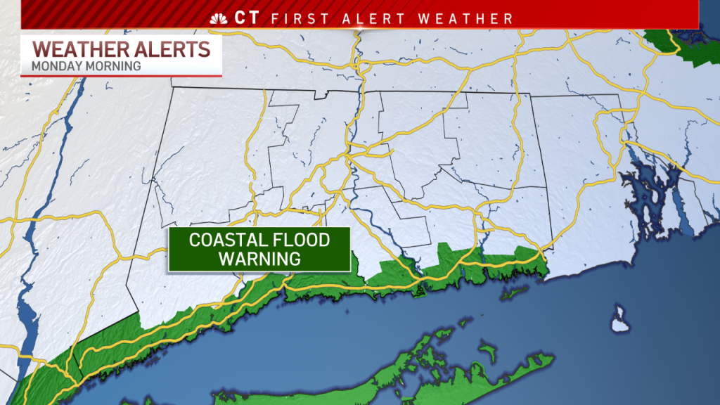
The biggest impact for southern CT will be coastal flooding and the potential for damaging wind gusts.
A Coastal Flood Warning has been issued for all coastal areas of Connecticut. Moderate to major flooding is possible as tides will be 3 to 4 feet above normal.


As the area of low pressure lifts to the north, the easterly component of the wind will transition to a southerly wind, which should help alleviate some of the major flooding concerns.
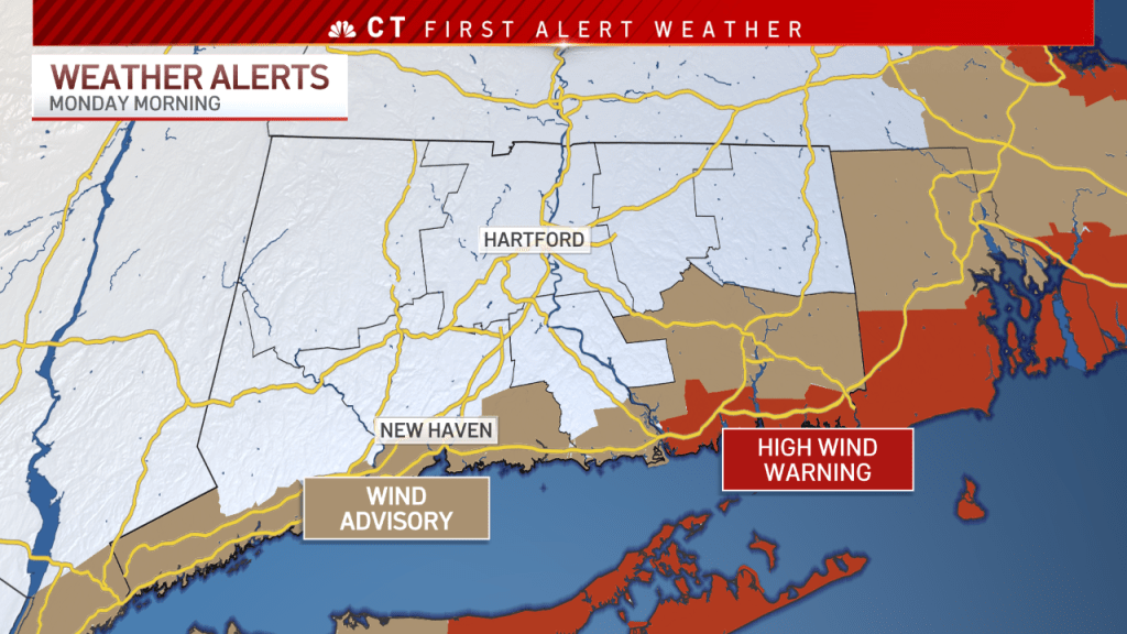
A Wind Advisory has been posted for coastal CT and all of New London county. A High Wind Warning is in effect for southern New London county, where winds could gust up to 60 mph.
The system will gradually come to an end as we head into Monday afternoon.