
Tropical Storm Isaias was one of the more unusual tropical events I've covered in the 15 years I've been a meteorologist in Connecticut. Irene was a classic tropical storm that we tracked for days and it had everything - damaging winds, inland flooding, and a devastating storm surge. Hurricane Sandy, while quite unusual in its track, was also a relatively easy forecast in Connecticut with storm surge and wind impacts expected days in advance.

Isaias, on the other hand, was a bit of an odd duck. The storm struggled mightily off the Bahamas and Carolinas and only reached minimal hurricane strength. We were quite confident in the storm track a few days out (either tracking over Connecticut or just to the west of Connecticut) and expected little rain and little storm surge. 48-72 hours before the storm hit we were expecting strong winds at or even over 50 mph but I was not anticipating widespread tree and power line issues with gusts 60-70 mph. 60 mph tends to be the threshold locally where things go downhill fast.
By Monday, August 3 I knew we were in trouble. Isaias was maintaining its strength as it tracked inland thanks to favorable interaction with the jet stream. Our computer models were more consistent in showing a tight core of strong winds on the storm's eastern flank.
The question always is with these setups is how much of this wind can reach the surface. In order to figure this out we look at the temperature profile. When temperatures decrease rapidly with height the atmosphere is unstable and the winds will mix to the ground. When temperatures decrease slowly or even increase with height the stronger wind aloft will struggle to reach the ground as the atmosphere is stable. The latter happens more often than not here on a southerly wind.
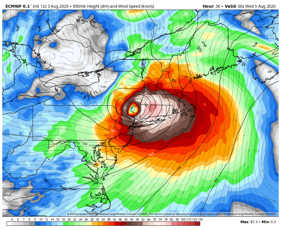
In this case the atmosphere was relatively unstable in the lowest levels which promoted efficient mixing. The stronger winds aloft (80 knots or more than 90 mph a few thousand feet up) were transported to the ground in unusual efficiency. The end result was widespread 60-70 mph wind gusts across Connecticut and remarkable damage to the power grid which is notoriously fragile.

It wasn't just the wind. For days we were concerned about the tornado potential with Isaias given an unusual combination of instability and powerful wind shear in Connecticut. While tornadoes from tropical cyclones are common in the Mid Atlantic and Southeastern U.S. they are unusual in New England - thanks in large part to the typically cooler water temperatures this far north which keeps the low levels of the atmosphere a bit more stable than they are down south.

The morning weather balloon launch on Long Island showed an environment primed for tornadoes with strong low level shear (soon to become extreme) and significant instability (including quite a bit in the 0-3km layer).
Isaias produced a tornado in Westport which is the first tornado on record in Connecticut associated with a tropical storm or hurricane. the damage was substantial to one home - thankfully the tornado lifted before doing more damage farther inland along the Saugatuck River.


The tornado was well warned by the National Weather Service and produced a classic signature on radar. Rotational Velocity of a bit more than 30 knots (62 knots of gate to gate shear at 1800 ft ARL).

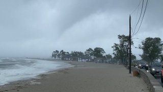
As the rain bands of Isaias moved across the remainder of the state powerful wind accompanied them. Gusts over 60 mph were common in many areas. From driving around the state after I noticed unusually concentrated areas of damage surrounded by little damage. The convection in the few rain bands associated with Isaias that impacted Connecticut helped mix some of the stronger wind just off the deck to the ground.

Radar at 2:40 p.m. (pictured above) detected winds over 75 knots (about 85 mph) just about 2,000 feet above the ground in parts of Fairfield County. Given the temperature profile in the lowest levels of the atmosphere and the convection ongoing we were primed for damaging winds.
By the time the storm was over one person was dead, nearly half the state was without power, and the power outages lasted for days. Another reminder how remarkably vulnerable this state is when it comes to hurricanes.


The storm was a challenging one to cover in a lot of respects. From the COVID-19 pandemic, to tornadoes in Litchfield County 2 days prior, it was a whirlwind 72-96 hours. In retrospect, I would have liked to have been more bullish on the potential for widespread damaging wind a couple days out but was happy we got the word out 24 hours in advance. No two tropical systems are the same and each come with unique forecast challenges. The 2020 hurricane season looks like it will be a big one - lets keep the next few storms away from New England.
