


Sunday Weather Blog
As expected, the weekend started dry but the first half ended with some showers on Saturday evening.
A couple of showers from Saturday night started the day on Sunday, but sunshine broke through during the middle of the day in to the early afternoon. The sun may have helped to develop showers once again (possibly a thunderstorm) Sunday evening.
Get Connecticut local news, weather forecasts and entertainment stories to your inbox. Sign up for NBC Connecticut newsletters.


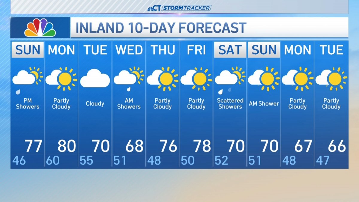
Temperatures were noticeably warmer Sunday with highs climbing well into the 70s away from the shoreline.
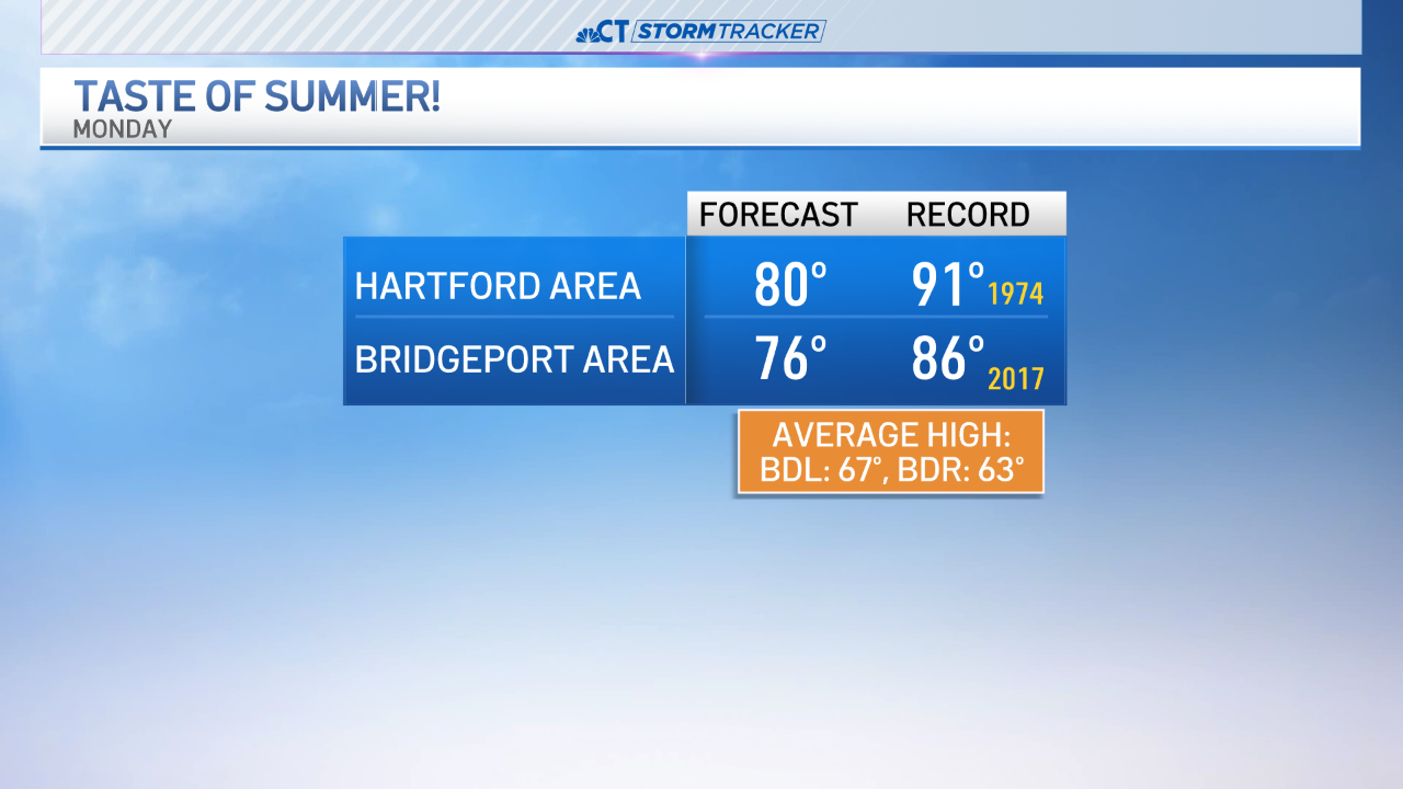
Monday, highs will be near 80 degrees - if not into the low 80s. That's more like early to mid-June !
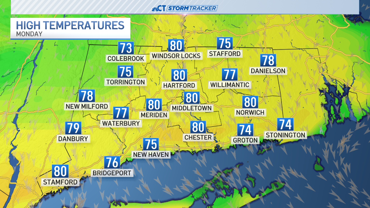
We're not expecting record highs on Monday, although high temperatures will be 10-15° above normal for late April.
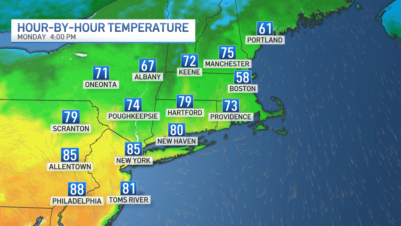
On Monday, cooler air will be close by to our east (notice Boston's temperature in the map below). We'll be watching for some of that cooler air to work in which will bring our high temperatures back into the upper 60s to lower 70s by Tuesday.
Have a great weekend!

