


Saturday Weather Blog
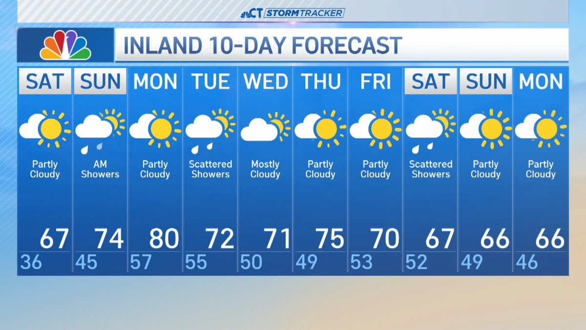
After a couple of cool days and cold mornings, a warming trend has started this weekend.
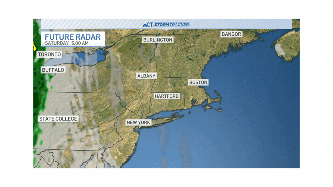
We saw a sunny start Saturday, but as a warm front approached from the west, we saw clouds by the afternoon and evening. Showers are moving through tonight and a few will linger on Sunday morning throughout New England.

Get Connecticut local news, weather forecasts and entertainment stories to your inbox. Sign up for NBC Connecticut newsletters.


Rainfall amounts are expected to be light. Generally under a half inch of rain for most of the state.
A few isolated showers move through before midday on Sunday but it'll be an overall dry start to the day. It'll be even milder - highs will peak in the 60s along the shoreline and 70s inland.

Some sunshine may break through during the middle of the day in to the early afternoon. The better chance of rain moves in later in the day with an increasing risk of scattered showers.

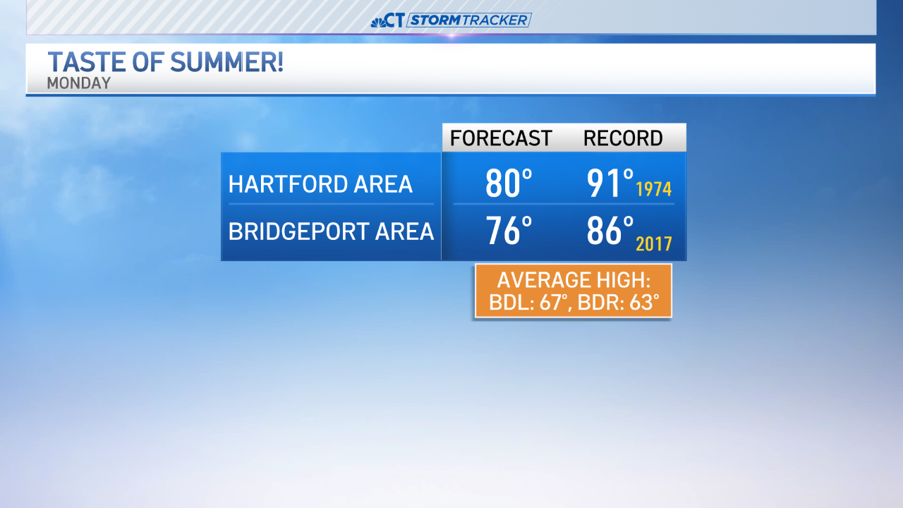
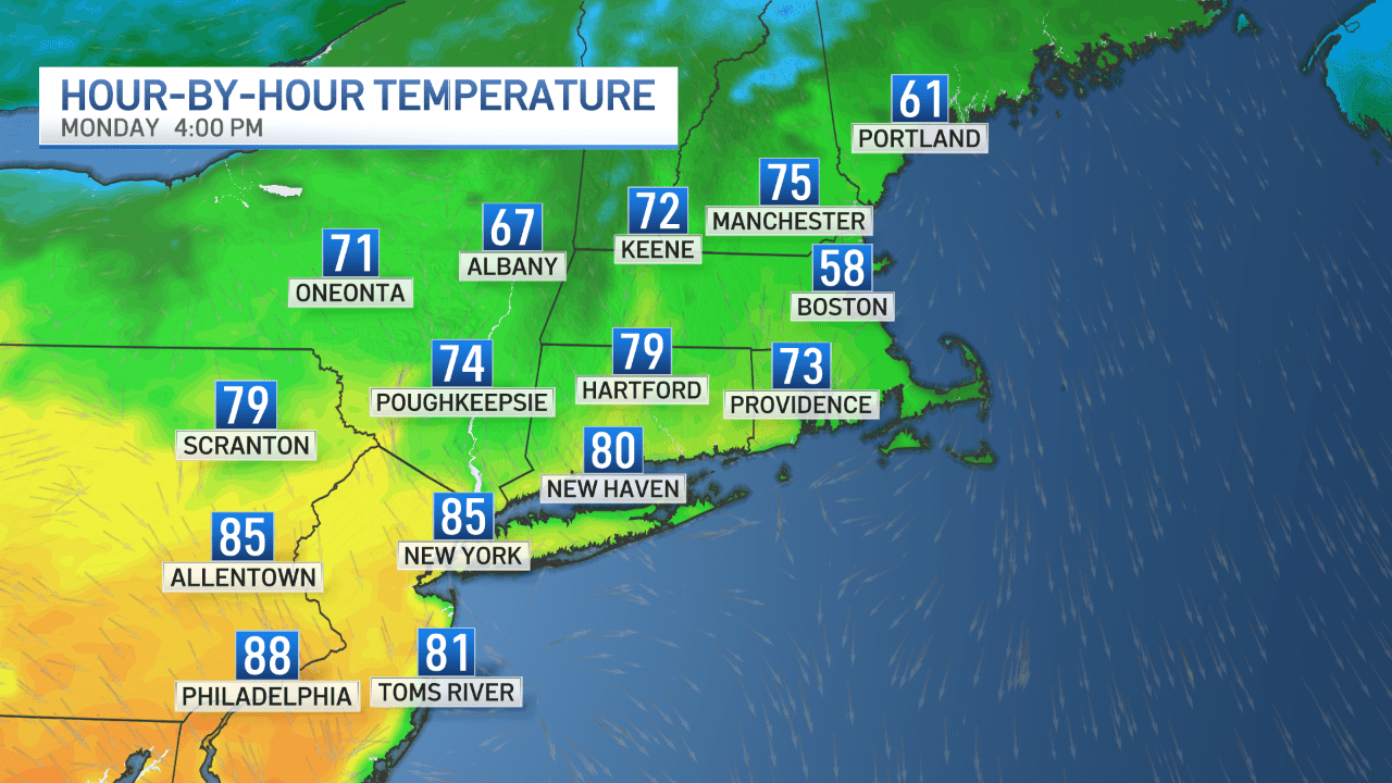
Monday highs will be near 80 degrees - if not into the low 80s. That's more like early to mid-June !
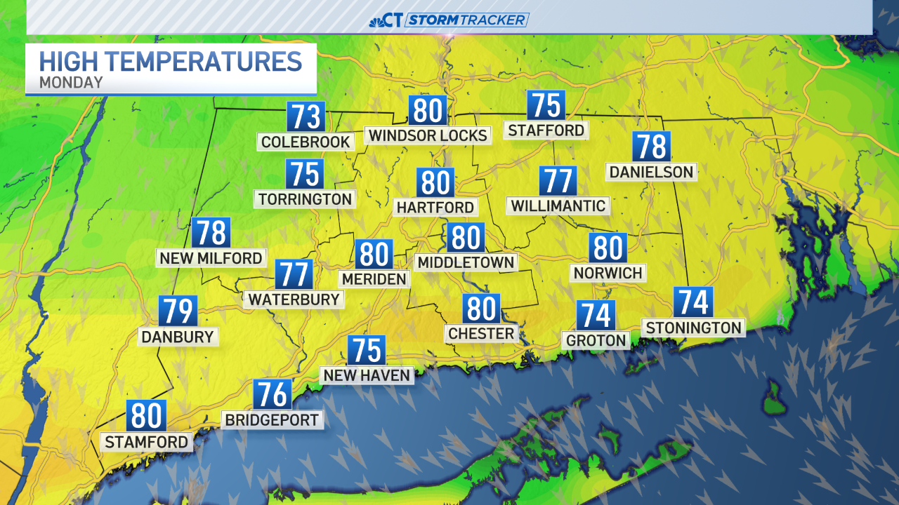
We're not expecting record highs on Monday, although high temperatures will be 10-15° above normal for late April.
On Monday, cooler air will be close by to our east (notice Boston's temperature in the map below). We'll be watching for some of that cooler air to work in which will bring our high temperatures back into the upper 60s to lower 70s by Tuesday.
Have a great weekend!

