
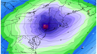
An unusually strong area of low pressure threatens to break the Hartford area's February low barometric pressure reading of 972.9mb. Current model guidance indicates the pressure may fall below 970 mb which is quite remarkable!
What's unremarkable is the weather ahead of this possible record. Little wind and not much rain will not raise many eyebrows as the barometer falls gradually.
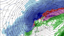
As the storm departs, however, the lower part of the atmosphere will dry out and the winds will ramp up. Some of our computer models indicate the potential for wind gusts over 60 mph at the shoreline with a very rapid pressure rise and a very strong pressure gradient.
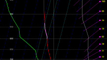
One useful tool for forecasting possible wind gusts is to look at wind gusts aloft and try to determine how much of that momentum will mix down to the ground. Once the storm passes and the low levels dry out the atmosphere will support quite a bit of mixing and we have the potential for some damaging wind gusts. Below you can see a "well mixed" layer from the ground up to about 5,000 feet up.
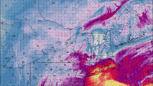
The question that remains is where exactly does the low track - if the low tracks over Connecticut the powerful wind will be shifted south toward Long Island. If the strongest low is over the Berkshires (which is generally an unusual track) the strongest winds would wind up over coastal Connecticut.
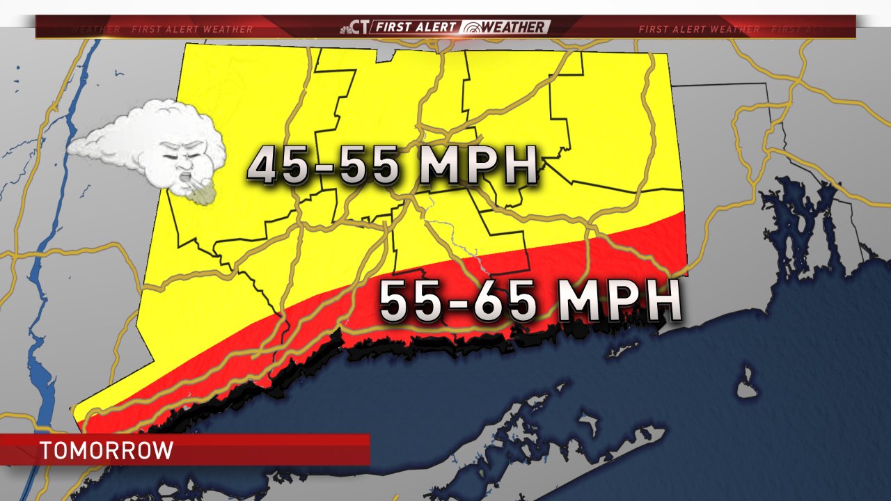
This is our current forecast which would indicate scattered power outages and tree damage - particularly in the shoreline. There is the possibility for a more significant event so we'll have to watch that closely.
The timing for the strongest winds will be 1 p.m. to 7 p.m. with the worst of the wind coming out of the southwest and west. Very large waves will develop on Long Island Sound as well.
