
Saturday Weather Blog
After a couple of cool days and cold mornings, a warming trend is on the way for the weekend.
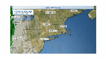
Expect a sunny start today, but as a warm front approaches from the west, we'll see clouds by the afternoon and evening. Some showers are expected this evening and tonight. A few showers will linger on Sunday morning throughout New England.
Get Connecticut local news, weather forecasts and entertainment stories to your inbox. Sign up for NBC Connecticut newsletters.
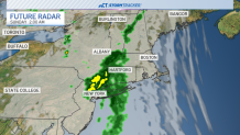
Rainfall amounts are expected to be light. Generally under a half inch of rain for most of the state.
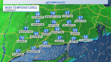
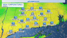
Highs will eclipse 70F away from the Sound on Sunday and by Monday highs will be near 80 degrees.
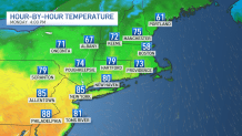
On Monday, cooler air will be close by to our east (notice Boston's temperature in the map below). We'll be watching for some of that cooler air to work in which will bring our high temperatures back into the upper 60s to lower 70s by Tuesday.
Have a great weekend!
